Tuesday, September 26, 2006

Hometown Photos

Georgetown, Louisiana, located in the north-central part of the state, has never been a big place. Way back when, it featured four grocery stores, a store that sold dry goods and appliances, plus a garage, a washateria, and a couple oil field related businesses. Today, there's one grocery store and a beauty shop. The town still has a high school (Bulldogs), post office, Masonic Lodge, and several churches. About 300 people continue to call it home.

Bayou Bill


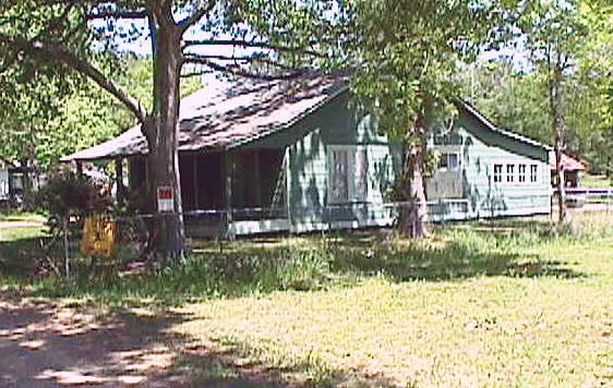
The original homestead. This house was built by my
grandfather who was the local carpenter. It's about
75 years old and in much better shape than me.

--


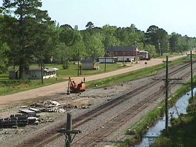
Skyline of the Georgetown, uh, business district.

--


Georgetown's skyscraper. The Federal Building
(aka post office) can be seen at bottom left.

Labels: , ,

Monday, September 25, 2006

Rivers and Creeks

While Georgetown, Louisiana lacks a Wal-Mart and
McDonalds, Kisatchie National Forest is next door so
outdoor activities are plentiful. Fishing, hunting,
swimming are all minutes away. The first day of deer
season was considered an excused absence when I
was in high school, but only if you went hunting. The
following photos were taken on the same day following
several days of rain, so the water is high and muddy.

Bayou Bill


Fish Creek is a meandering, spring-fed source of
recreation south of town. This is "Iron Bridge," a small,
shallow swimming hole where Elizabeth Barrett taught
me how to swim. A modern, safe, dull bridge has
replaced the old structure and it's intricate iron girders.

--


Several miles upstream from "Iron Bridge" was the
"Kent Hole," considered the spot of choice by teenagers.
Located in a sharp, "L" shaped bend, it featured high
bluffs on one side, a small sandy beach on the other and
a rope swing for showing off. Several years ago the bluff
collapsed. The photo was taken facing upstream from
the bluff area.

--


North of town is Little River. Way back when, this
river was a poster child for pollution. It is now
much cleaner. This shot was taken from the old
bridge facing downstream toward the "new"
US 165 bridge. In this case, "new" is a relative
term since the bridge was built in the mid '50's.
Georgetown is a couple miles to the right in this
photoe, while Tullos is about the same distance to
the left. A large lumber mill was located on the
right side of the river. There are accounts of
small steamboars navigating this far upstream.

Labels: , , , , , , , ,